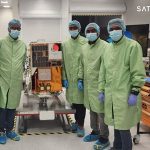
Apart from the mandate of building Emirati scientific expertise, Dubais earth observation satellites will explore commercial opportunities, says Salem Humaid Al Marri, director of the EIAST space programme. It is difficult to talk profits and balance sheets when the information that is coming in is monitoring a nuclear plant in crises or a country-wide flood […]

Apart from the mandate of building Emirati scientific expertise, Dubais earth observation satellites will explore commercial opportunities, says Salem Humaid Al Marri, director of the EIAST space programme.
It is difficult to talk profits and balance sheets when the information that is coming in is monitoring a nuclear plant in crises or a country-wide flood situation that has uprooted millions. And when the information also helps us understand what tomorrow will bring in terms of changing coastlines and forests, you cannot put a price tag on the services.
“Helping during disasters such as the Japanese tsunami or the floods in Pakistan for the UN, or supporting research on coastlines and the like, will always take priority over any commercial considerations for us,” asserts Salem Humaid Al Marri, director of the space programme department of Dubai-based, The Emirates Institution for Advanced Science and Technology (EIAST). The issue of commercial applications came up almost immediately because Ahmed al Mansoori, the director general of EIAST has been quoted in the local press saying: “While the first satellite was for knowledge transfer, this second satellite will be looked at as more of a commercial [venture].”
To be launched in the fourth quarter of 2012, DubaiSat-2 will be capable of an increase in the speed of the data download from 30 Mbit / second, as is the case in DubaiSat-1, up to 160 /Mbit/second, in addition to increasing the amount of data acquired by the satellite per day from 12,000 square metres to 17,000 square metres. With these technical improvements, the weight of the satellite is now 300 kgs and its size is two metres in height and 1.5 metres wide.

The orbital height of the satellite has been modified to 600 kms above the earths surface compared to 690 kms, which is the current orbit of DubaiSat-1. The orbit has also been changed from an ascending orbit (South to North) to a descending orbit (North to South), which will allow both satellites to work well in constellation as well as give better coverage over the UAE area.
Customised imaging
Of the commercial potential, Al Marri says, “The satellite will have a panchromatic resolution of 1m and a multispectral resolution in of 4m in four spectral bands (red, green, blue and near infrared). This would enhance the quality of the images for various applications including environmental projects, urban planning, infrastructure, telecommunications, electricity and the oil and gas sectors, among others. We dont just provide images. We work on the different frequency bands in the image and produce products based on client needs. With an adjustment in how we use the different frequency bands, for instance, you can detect if there is a higher level of chloroform in the plants. Once we know what the clients are looking for, we can make the necessary adjustments and provide the right sort of image.”
Globally, al Marri sees demand from South America and the Far East. “Countries such as Brazil take images from many earth observation satellites because of the constant cloud cover over the country that makes the task of image capturing from space, challenging. The same with countries in the Far East. Regionally, we have forged an understanding with the Central Informatics Organisation in Bahrain. They would earlier take images from other satellite agencies just as our government organisations did. We are now informing them about the advantages of using us, given the quick turnaround time in terms of response to their image needs.”
Developed at the cost of under $50 million, Al Marri says it will be one of the best performing satellites in space in the 300kg category, Al Marri explains, “Other than resolution and number of images we can download, there are technology demonstrators on board. We have a propulsion subsystem which allows us to move the satellite in orbit we can go higher or lower or we can maintain orbit if the satellite stays up there for longer. This was jointly developed by the Japanese Space Agency (JAXA), the Korea Advanced Institute for Science and Technology (KAIST) and our team.”
Improved ground facilities
With two satellites in orbit next year, Al Marri s team is working on expanding the ground facilities with an antenna in Norway making 14 contacts every day. This is in addition to the two contacts the ground station in Dubai makes and an antenna in South Korea is expected to be commissioned soon, doubling the capability of download. Commenting on the plans under way, Al Marri says, “As we expand our distribution base globally we are looking at more partners and more efficient ways of downloading images wherein partners would download directly, a certain number of images, to save on time and cost.”
The economics of an earth observation satellite is difficult to quantify and is open to debate but a national space programme such as the one launched by EIAST in 2006 has non-monetary compulsions and here they have made tangible strides. DubaiSat-2 represents not just the doubling of Emirati engineers from eight to 16 and counting, but a collaborative effort by the Emiratis with S.Korean engineers that has risen from 30% for DubaiSat-1 to 50% for DubaiSat-2.
“We want to become a satellite manufacturer,” says al Marri. And this is not mere rhetoric. The specifications for DubaiSat-3 are already being put together by EIAST and there is every possibility that the fourth satellite will be developed in the EIAST premises on the outskirts of Dubai.
DubaiSat-1 is the UAEs first earth observation satellite. DubaiSat-2 The DubaiSat-2 project is a joint development programme between EIAST and SatrecI of South Korea, in which 16 UAE engineers have been working on the design, development, testing and manufacturing of the satellite. DubaiSat-2 will be launched on board a Dnepr Rocket through the Moscow-based International Space Company Kosmotras (ISCK) from Yasny Cosmodrome in Russia by the fourth quarter of 2012. DubaiSat-2 is an electro-optical earth observation satellite system with a Ground Sampling Distance (GSD) of 1m at 600km sun-synchronous orbit.


