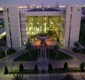
KACST will use the National Center of Remote Technology to capture high-resolution data of the Red Sea Projects development sites every month.
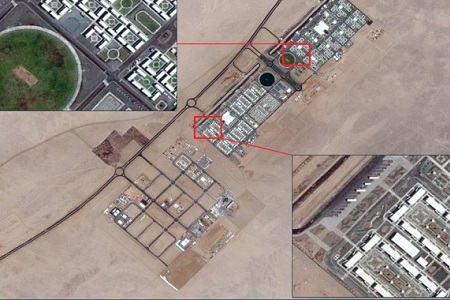 Saudi Arabia’s Red Sea Development Company (TRSDC) has signed a contract with King Abdulaziz City for Science and Technology (KACST) to provide high-resolution data for key locations at the company’s headquarters.
The data is collected using satellites to monitor the progress of the Red Sea project, which covers an area of 28,000 square kilometres, and to track developments in real estate assets more effectively.
Speaking about the contract, John Pagano, CEO of Red Sea Development Company, said: “Given our ambition is to enhance the environment, gaining reliable, detailed and timely visual insights is crucial to understanding how our development progress is affecting the precious habitats at the destination. Through this partnership with KACST, we are able to monitor key assets, both built and natural, during the construction phase which will significantly support our efforts to deliver a regenerative approach to tourism development.”
KACST will use the National Center of Remote Technology (NCRST) to capture high-resolution data of the Red Sea Projects development sites every month. The imagery will be colour-balanced, georeferenced, orthorectified, with (NCRST) using satellites GeoEye-1, Worldview and Pleiades to capture images.
The satellite data will then be integrated into TRSDCs Geographic Information Systems (GIS) and Building Information Models (BIM) to provide seamless access to the imagery for TRSDCs planning, engineering and environmental departments.
Specifically, TRSDCs GIS department will overlay the latest masterplans and detailed designs onto the satellite data to monitor progress and detect clashes.
The data will also be used to identify optimal routes/sites for construction activities in addition to becoming an invaluable addition to monthly progress reports.
Dr Talal Alsedairy, Supervisor of the Space and Aeronautics Center at KACST, added: The NCRST is ready to support TRSDC and provide world-class satellite imagery of its project area that will enable it to gain deeper insights into how construction is progressing and what impact its work is having on the surrounding environment.”


